
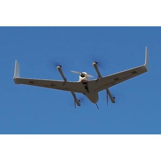
Stars-05 UAV can take off and land vertically and cruise rapidly in the air, which greatly improves the portability and security of use. It can not only carry mapping camera to measure farmland accurately, provide precise positioning information for plant protection UAV, but also carry multi-spectral camera to monitor farmland diseases and insect pests, so as to realize precision agriculture. In addition, it can also mount multi-rate monitoring pods, which can be used in urban planning, River patrol, Power Patrol and other fields.
Wingspan:1.8m
A plane captain:1.0m
Packing box size:130*60*30cm
Maximum take-off weight:5kg
Maximum load weight:500g
Working temperature:-20~50℃
Cruise speed:22m/s
Practical Lift:3000m
Duration of voyage:1.5h
Measurement and control radius: 30km
Wind resistance: 7level
Battery capacity:6S 10000mAh
Load Types: Photoelectric Pod, Multispectral Camera, Surveying Camera
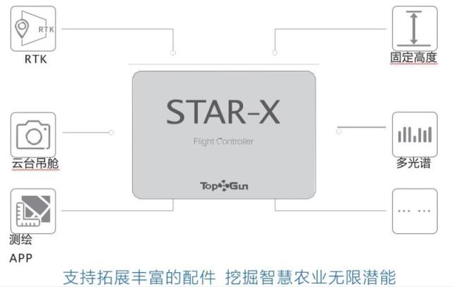
Stars05Equipped with dedicated flight control system, it has two control modes: multi-rotor and fixed-wing. It is easy to operate and can achieve one-key takeoff and landing. Using high reliability redundancy design, equipped with two sets IMU The system integrates airspeed, altitude, magnetic heading and other information, and can control the smooth flight of the aircraft.
Provide precise navigation for plant protection UAV:stayT410 Users of plant protection UAVs before large-scale farm operationsUse stars05 Unmanned aerial vehicles measure farmland and then generate farmland heightClear the map, return the map information to attack the cloud. No one is protected by the use of pioneering plant protection Aircraft Ground Station, Download High Precision Farmland from Encrypted Cloud anytime and anywhere Map, click on the plot to generate accurate routes, greatly shorten the route planning Time, fast implementation of plant protection UAV precise flight.
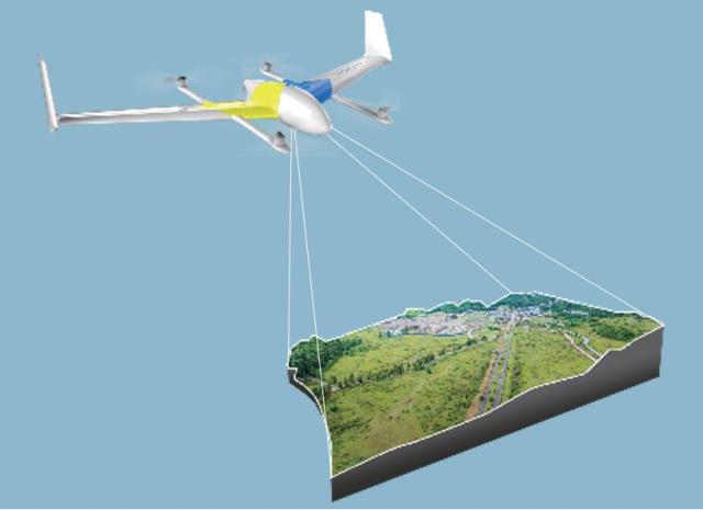
Provide efficient tools for surveying and mapping industry:Stars 05 Simple and easy to use, data acquisition does not require professional pilot operation, only one key operation can complete the flight. Flying speed, high efficiency, and effectively improve operational efficiency. Lightweight surveying and mapping can not only greatly shorten the operation time and reduce the intensity of the operation, but also greatly reduce the cost of manpower.
To provide scientific data for smart agriculture:Through the stars05 Multi-spectral camera mounted for high-definition of farmland and orchard Image acquisition is used to establish data archives for the growth of crops and trees. Users can view historical data anytime and anywhere to monitor the status of pests and diseases. To help yield assessment and realize intelligent management of farmland data.
Provide a reliable platform for industry users:Reliable stars05 Flight platform can be customized according to industry requirements. Multispectral cameras, multi-zoom pods, light lidars, etc. Prepare. Provide surveillance cameras and fire patrols for public security, fire protection and environmental protection departments, etc. Logic, Electric Power Inspection, Urban Planning, Emergency Monitoring, Natural Disaster AssessmentEstimate solutions.