
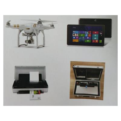
Product Profile:
Road traffic accident scene aerial photography measurement system is a revolutionary product to create a new mode of traffic accident scene investigation. It is a high-tech product that integrates intelligent UAV and traffic accident mapping perfectly. It integrates aerial photography, measurement, mapping and printing into one traffic accident detection system.l
Product characteristics:
1. Intelligent UAV is used to save time and effort, and the site investigation is completed within 10 minutes of major accident, which is convenient to use.
1. Automatically setting "return point" to display UAV status information and flight information in real time (such as signal, intensity, power, flight speed, etc.).
3. One-click take-off, one-click landing and one-click return;
4. Built-in map, visual display of return point position, flight position, flight direction
And other information;
L 5. Real-time display of the picture captured by UAV camera;
L 6. Up to 12 million pixels of still photo shooting, can support JPEG and
DNG RAW format, full of details;