
1. Intelligent UAV and "Road Traffic Accident Site Mapping System" can be used together to facilitate the use of products.
* 2. It can be directly used in conjunction with the "Traffic Accident Scene Surveying and Mapping System". It can directly draw the scene record and scale map of the accident scene on the tablet computer without importing the photos into other equipment.
3. Design and develop an independent flight control interface, which is more suitable for road traffic accident scene investigation.
4. Time-saving and labor-saving. Site investigation should be completed within 10 minutes of major accidents, traffic should be restored quickly, and road congestion should be avoided.
*5Automatic settings"Return point", real-time display of UAV status information, flight information (such as signal strength, power, flight speed, etc.);
6. One-click take-off, one-click landing and one-click return;
* 7. Built-in map, visually display the position of return point, flight position, flight direction and other information;
8. Real-time display of UAV camera pictures;
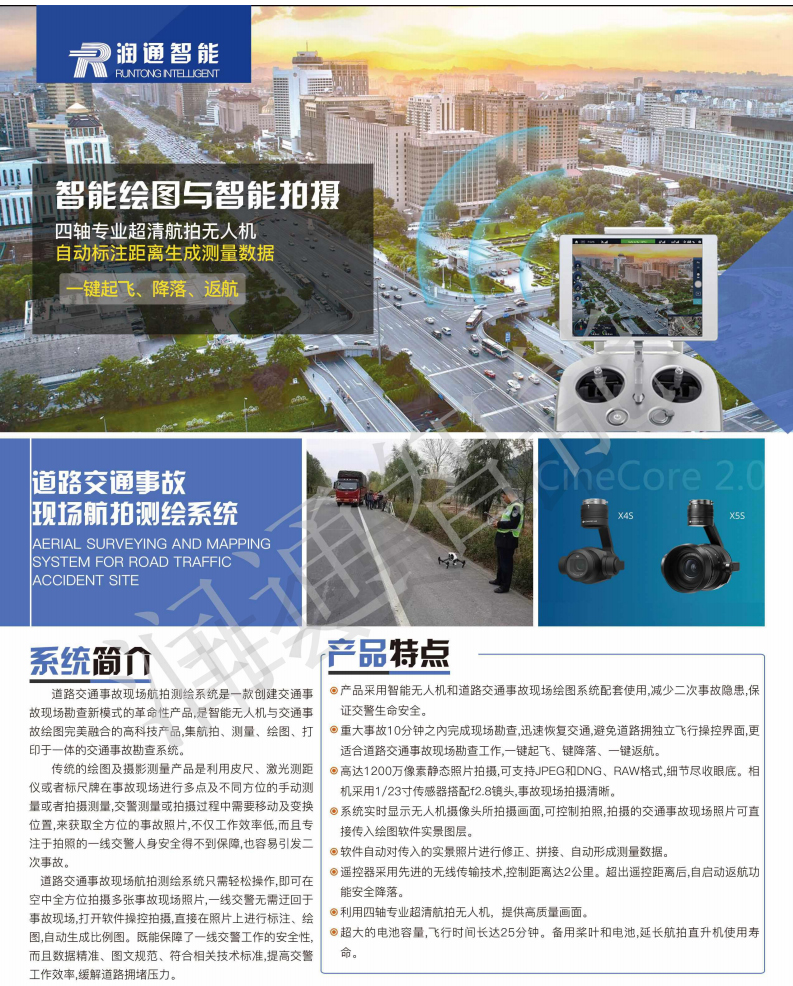
9. Up to 12 million pixels of static photography can support JPEG and DNG RAW formats, with full details. The camera is equipped with 1/2.3 inch sensor and F/2.8 lens. The scene of the accident is clear.
* 10. Controllable photography. The traffic accident scene photos can be directly transferred into the real scene layer of the drawing software.
* 11. The software automatically corrects the incoming live photos and generates measurement data.
12. The remote controller adopts advanced wireless transmission technology to achieve stable signal transmission, and the control distance is up to 2 km.
* 13. Reproduce the scene of the accident from multiple angles, and generate real scene and scale map.
14. Use the stabilization function of three-axis gyroscope to prevent camera jitter and provide high-quality pictures.
15. The UAV has vibration, tilt and rotation in flight. The platform can compensate in real time, keep the camera picture clear and steady, and take smooth pictures calmly in motion.
16. Intelligent UAV landed safely after it exceeded the range of remote control.
17. When the UAV is far away from the field of vision, it can turn on the lockout mode of return point. No matter where the UAV head is, it can grasp the flight direction and pull back the rocker to return easily.
* 18. Take pictures with the camera of the UAV, display the pictures in the tablet computer, acquire data on the pictures, label them, locate line, locate point, reference point, etc.
* 19. The system provides four layers, which can separate road, symbol, trace and UAV scene layers to avoid misoperation. TwentyIn line with the latest version of the national standard, supporting printing"Road Traffic Accident Scene Record Map"
21. Bluetooth Laser Range Finder can automatically connect with software and receive measurement data.
22. Cross-platform windows, windows mobile, android, IOS
23. Support multiple photos and drag-and-drop for data association
24. Characters such as vehicles and ground objects can be added to the corresponding accident scene position on the photograph. The system has the function of automatic adsorption, which can adsorb the wheel of the characters to the position near the fixed point.
*25Support multi-view automatic conversion to"Scale Map of Road Traffic Accident Site"
* 26. Print the scene record and scale map of traffic accident scene by Bluetooth printing
27. Support map navigation UAV returning 28, three-dimensional data acquisition to provide fast accident recovery analysis.
(4)The system can draw the scale map of traffic accident scene quickly and accurately, draw the scene map by computer, automatically and quickly draw the sketch of road traffic accident scene, generate the scale map according to the requirement, and automatically generate the record of accident scene investigation.;(5)There are three independent drawing layers in the system, which can distinguish roads, icons and traces. The layers can be stored in layers by layers, so that no interference can be caused in drawing, and the wrong operation can be avoided effectively. Supporting triangular and right-angled positioning methods used separately or in combination, automatic and manual annotation can be used.;(6)The drawing process conforms to the traditional drawing process habit of police officers. It does not need to fill in forms, and WYSIWYG is easy to find errors in real time. The operation adopts full left-click dragging operation mode, completes the same operation with the least number of keystrokes, shields right-click operation, and facilitates operation on tablet computer and field use.;(7)It is easy to draw various forms of roads (such as straight roads, forks, etc.) with a handwritten pen.SBends, intersections, T-junctions, various complex intersections, road profiles, unequal broad roads, irregular roads, etc.;(8)The parameters of the whole road can be set, and the parameters of each road can also be set (e.g. the width of lanes, the number of lanes, the width of individual lanes, etc.). The shape and style of various markings and green belts can be adjusted arbitrarily.;(9)Special roads can be generated (e.g. expressways, urban and rural roads, County roads, etc.).SShape road, etc.SV-bend can be dragged freely by multiple control points, and various data can be marked automatically.;(10)It has the function of road memory, which can store the roads involved in the field maps and be easy to call directly in the future. It also has the function of road pre-storage, which can input the template of accident-prone sections and complex sections in advance, so as to make the field mapping more convenient and fast, or use it in combination with electronic map data.less thanData provided by usersgreater than;(11)Open symbol library, labeled symbols are drawn according to national standards in advance, users can add non-standard symbols manually; all other symbol libraries are managed by open database, which is easy to add, delete, modify or personalize according to regional characteristics.;(12)The labeled symbols should be added according to the national standard, and special symbols can be added manually. Open management of road map database and vehicle feature symbol is adopted in order to add, delete, modify or set individually according to regional characteristics.;(13)Automatically adjust the size and position of the input data to determine the required positioning data,And input the measured data into the corresponding items of the computer.,Click on the automatic adjustment button to adjust the position of each icon element in the actual position relationship transfer diagram. The automatic marking line and location distance can be automatically generated to avoid missing important parameters.;(14)The system provides error warning function, which can prompt for data missing, data redundancy and data logic errors, so as to avoid errors in exploration or data filling. The system has“Revoke”“recovery”Function keys, for each step of operation, can be restored operation;(15)Various object symbols and necessary text descriptions can be added at any location.;(16)Provide timely inquiry function of laws and regulations, and guide work at any time;(17)Information related to on-site investigation can be preset in advance (e.g. case handling unit, name of case handling personnel, weather, road condition, etc.);(18)The system can print on-site inquiry and interrogation transcripts, save questions and answers and edit words in real time. The system can generate and print on-site investigation records, on-site inquiries and interrogation records, which provide the functions of question and answer pre-storage and text editing. Statements are availableworldSeamless docking, all report files can be achieved toWORDFormat export, easy to edit and process on other office equipment;(19)Provides automatic saving function. When accidentally exiting, the system can save the last record in real time, so as to avoid data loss caused by wrong operation and system errors.;(20)It can adjust the proportion of field maps arbitrarily, and can make its own printing paper type according to local conditions. It can choose horizontal or vertical template or customize the size of template (postcard or wallchart). Segmentation printing can be used for large-scale accident scene.(4-36Block);(21)Files can be saved asJPG、BMPFormat pictures to facilitate network transmission and leadership review;(22)It can print and output field maps, field investigation records and other documents and forms wirelessly. All report forms and documents can be realized to the same direction.WORDFormat export, easy to edit and process on the Internet and office system;★(23) The system can realize cross-platform operation, and the generated drawing source files can be in Android.(AndroidApple(iosMicrosoft(windowsMicrosoft(windows moblie)The four platforms run simultaneously on the equipment and share data across platforms.★(24) Providing "Traffic Accidents"three-dimensionalSystem InterfaceIt can automatically generate the three-dimensional dynamic effect of the accident scene.★(25) It has the function of automatic direction recognition on site and realizes road orientation by means of magnetic azimuth angle. Finger North needle and scale should have adjustable function, default finger north and scale1:200Proportion. (26) DigitalPhotogrammetric function,Multiple sheetsPhoto correlation measurement, andPrinting《RoadScene Record of Traffic Accidents》