
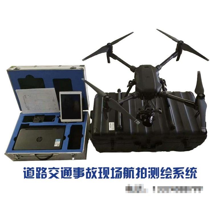
Accident Mapping/UAV Accident Aerial Mapping System:
At present, traffic policemen survey the scene of traffic accidents by measuring the tape, drawing the scene sketch manually, and then drawing the scene scale map according to the sketch. This method has some shortcomings, such as repetitive work, slow drawing, low efficiency, and information can not be exchanged and shared.
In order to improve the present situation of hand-measured and hand-drawn scale maps for traffic police in accident scene investigation, a set of professional products suitable for traffic police to draw scene scale maps simply and quickly are formed by the comprehensive application of software and hardware and the advantages of computer information processing. It realizes digitalization of traffic accident scene data, and can easily connect with traffic accident business processing and traffic illegal business processing systems. It provides fast and accurate means for on-site traffic accident investigation, and makes the road traffic accident processing more efficient, scientific, standardized and convenient.