
Trimble Flightwave Remote Positioning Technology for Migration Measurement
Convenient and efficient collection of GIS data through remote measurement
Shadow Elimination Technology for Trimble Floodlight Satellite
In harsh GNSS environment, more positions can be measured with higher accuracy.
Data Acquisition from Terminal to Terminal
Flexible software options, support customized research and development, convenient for collecting, processing and managing GIS data
Supporting BeidouGPSGLONASSGALILEO and other satellite systems to achieve efficient GNSS data acquisition
Set Bluetooth, WIFI, digital camera, 3.5G communication module in one to deal with all acquisition tasks at any time
Physical dimensions
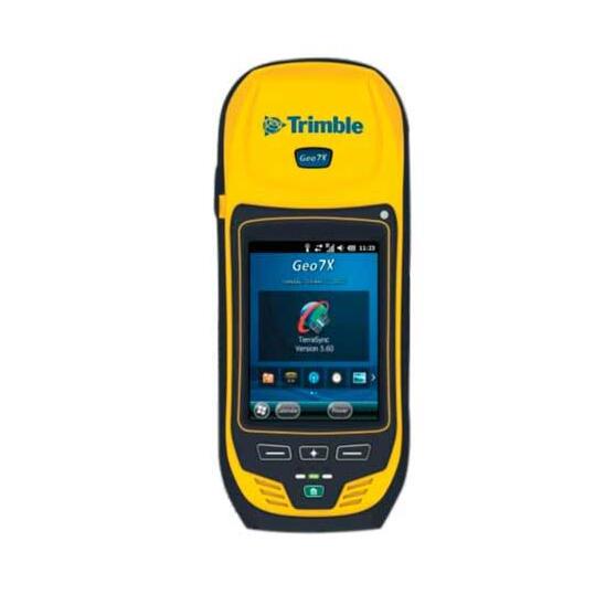
Geo 7X handset: 234mm*99mm*56mm
Geo 7X handset: 963g
Geo 7X handset with range finder 1080g
GNSS, Azimuth, Distance
GNSS Sensor: L1/L2 GNSS Receiver and Antenna
Chipset: 220 Channel Trimble Maxwell 6
Systems: GPS, GLONASS, Galileo, Beidou, QZSS
SBAS:WAAS、EGNOS、MSAS、GAGAN
SBAS+: Yes
Floodlight: Yes
Receiver protocols: NMEA, TSIP2
Update rate: 1Hz
Fixed time for the first time: <45 seconds (usually)
Real-time Correction Protocol: RTCM2.x/RTCM3.x/CMRx
Real-time centimeter mode accuracy
Level: 1cm + 1ppm HRMS
Vertical: 1.5cm + 2ppm VRMS
Post-processing centimeter model accuracy
Level: 1cm + 1ppm HRMS
Vertical: 1.5cm + 2ppm VRMS
H-Star () Accuracy: 10 cm + 1 ppm HRMS
Code Accuracy (Real Time): 75 cm + 1 ppm HRMS
Code Accuracy (Post Processing): 50 cm + 1 ppm HRMS
SBAS Accuracy: Usually at Ami Level
Azimuth sensor: 3-axis gyroscope, magnetometer, accelerometer
Heading accuracy: 1.5 & deg;
Inclination accuracy: 0.5 & deg;
Roll accuracy: 0.5-deg;
Range Sensor: Laser Range Finder Module (Unique for High Configuration Model)
Communication protocol: owned by NMEA or Trimble
Passive range: up to 120m
Reflection range: up to 120m
Accuracy: 0.05m
Range accuracy: 0.01M
Network and Wireless Connection
GSM/GPRS/EDGE: 850 / 900 / 1800 / 1900 MHz
UMTS/HSPA+ :800 / 850 / 900 / 1900 / 2100 MHz
CDMA/EV-DO Rev. A:800/1900 MHz (Verizon authentication)
Wi-Fi:802 .11b/g
Power Supply and Battery
Type: rechargeable and removable lithium batteries
Capacity: 11.1V 2,500 mAH
Charging time: less than 4 hours (usually)
Real-time DGNSS usage (by integrating 3G/3.5G): up to 7 hours
Real-time DGNSS (via Bluetooth): up to 9.5 hours
Non-GNSS usage: up to 24 hours
Standby: up to 50 days
System CPU, Memory and Camera
CPU:Texas Instruments DM3730 1 GHz + GPU
Memory: 4 GB user memory + SD slot (up to 32 GB), 256 MB RAM
Camera: 5 MP
Display screen and touch panel
Display screen: 4.2 & quot; VGA (640x 480) LED semi-transparent reflective
Touch Panel: Resistance Touch Panel with Polarization Filter
Brightness: 280 cd/m2
operating system
Synchronization with computers requires installation of Windows 7, Windows Vista or Windows XP Home or Professional Edition (with Service Pack 3 or higher). Some field applications and services require mobile Internet access support.
Environmental use
Peripheral temperature of operation: 20-deg; ~60-deg; C
Storage temperature: - 30 & deg; - 70 & deg; C
Relative humidity: 95% non-condensation
Maximum working height: 9,000 M
Maximum storage height: 12,000 M
Waterproof/Dust-proof: IP65
Functional impact: MIL-STD 810G Method 516.6 Procedure I
Fall: 1.22 M
Vibration: MIL-STD 810 G Method 514.6 Procedure I