1. Electronic Map: Through the electronic map, you can see the geographical location, status and other information of the display personnel. Through the map, you can see the topography, landform and nearby buildings, street scenery, etc. of the current position of the personnel.
2. Trajectory inquiry: The trajectory of personnel and electronic foot button can be inquired through the system.
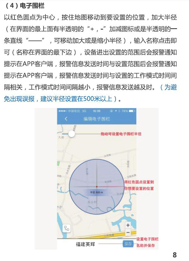
3. Electronic fence: It can limit the range of people's activities by setting the required fence area, and it will alarm once the personnel exceed the set range management platform.
4. Alarm reminder: When battery power is less than 20%, system support will pop up to give alarm reminder in the form of sound, graph and text.
5. Status display: The system will display the current equipment power, location, real-time location and other status information. (Handheld terminals and command centers are functionally identical)